Morgan Utah Road Trip

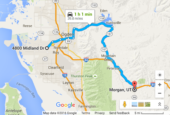
A couple weeks ago my wife and I decided to take a Sunday road trip to Morgan, Utah. I pulled up Google Maps and selected the small nearby town as our destination. I selected the “Avoid Highways” option to see what route it would send us on. According to Google, the trip would be about an hour, one way. We opted to hop on the freeway for the return trip, cutting the ride home to half an hour.
It was around 10:30 in the morning when we headed out. That put us in Morgan at about 11:30 so we talked about grabbing lunch once we got there. Being Sunday in a small town probably meant only fast food places would be open.
It was a sunny day, one of the nicest days of spring yet, and it was a great drive. We went up Ogden Canyon; a very tight and windy canyon road that follows the Ogden river through a rocky bit of the Wasatch mountains. We whipped past Pineview Reservoir which was still covered in thin cracked ice.
We made a right turn and headed over Trappers Loop. It’s a nice wide 55 MPH road that runs over a hilly mountain range. There was a large group of sport bikes out for their first tides of the year. Dozens of them parked on the byway. At the gas station as we came off of Trappers Loop there were a few more sport bikes, apparently stopped by three police offices; a Sheriff, Highway Patrol, and DNR. I’d never seen DNR on a traffic stop.
Now out of the hills, we headed East on a small country road that followed the Interstate the rest of the way to Morgan. We grabbed a sandwich and some chips at Subway and sat there to eat. When we were done, we caught the freeway for a quick trip home.